QTopo Digital Mapping
As we all know, the Internet has changed many areas of life such as government services, and this includes topographic map provision. Locally, the Queensland Government's excellent QTopo website, http://qtopo.dnrm.qld.gov.au provides access to free digital maps, and other location data. Here's a quick tour of the QTopo website
.
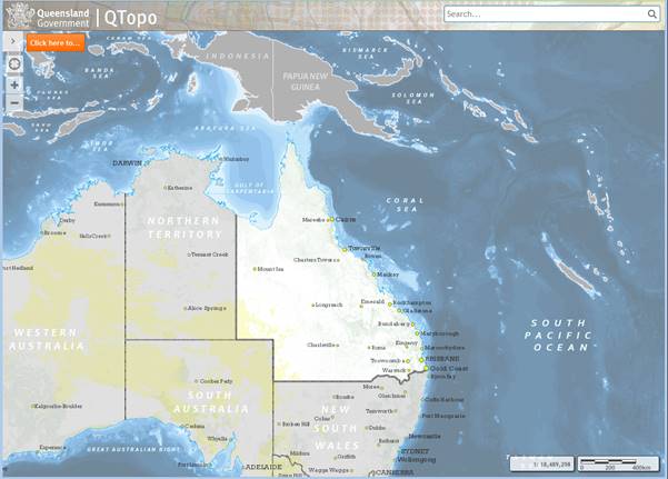
When the website loads (it can be slow at times), you can see a map of Qld, the usual zoom in/out buttons at top left, the current mapping scale at bottom right, and a large orange button at the top for task selection. For most walkers, this will be either the "Download a standard map sheet" or the "Generate a printable map" option. I'll discuss these in order, but first you might like to zoom in to the area of Qld where you would like a map.
Download a standard map sheet. The easiest option. Hit the orange "Click here to ..." button, select "Download a standard map sheet", and two things will happen: you will be requested to select the scale of the map to download, and map boundaries will be drawn on the screen.
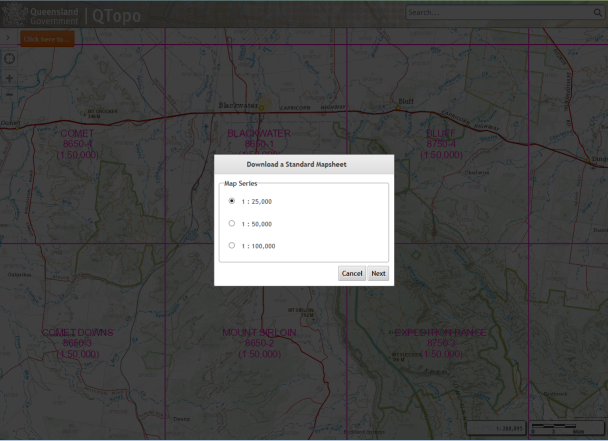
QTopo website showing 1:50,000 map boundaries in the background.
Full topographic maps are now available for anywhere in Qld at all map scales: 1:25,000, 1:50,000 and 1:100,000. Which map scale gives the "best" map for a particular area will depend on a number of factors, particularly where the area of interest lies in relation to map boundaries. For example, Mt Sleipner in the Berserkers lies near the edge of a 1:25,000 scale map, but is roughly centred on the 1:50,000 scale map, and the latter map contains as much detail as the 1:25,000 scale map. Zoom the screen map in or out as appropriate to see the desired scale map boundaries.
Once you have the desired map showing on the screen, you can select it in QTopo by either name (if available) or number, and proceed to download the selected map sheet, in PDF format (so you will need Acrobat Reader or Foxit Reader etc. to view the map).
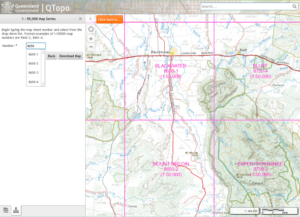
Selecting a map by map number.
File sizes are around 15MB, and are designed to be printed on A1 sized paper (59 x 84cm), however on many occasions only a part of the map needs to be printed, and this can be selected using the Snapshot feature of the PDF reader (check what resolution the Snapshot selection uses if your selection is blurry). Paste the selection into a paint/image edit app. The map images benefit from a sharpening operation if your image editing program has it, and despite the name, an Unsharp Mask gives best results.
Generate a printable map. What if the area of interest lies near the boundaries of any of the available map scales (e.g. Mt Atherton at Byfield)? Then it is possible on QTopo to generate your own map. Make sure before you do this that you have zoomed the screen map in to better than the desired map scale and centred the desired area on screen before you request map generation.
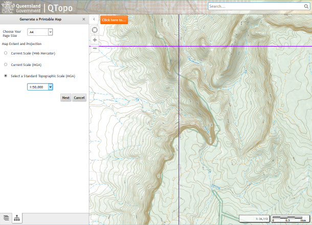
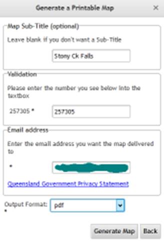
Generating a 1:50,000 scale map for the Stony Ck Falls area.
In this option, you are asked to select the printed size of the map (probably A4), and the map projection. Do not choose the default Web Mercator projection, but one of the MGA (= WGS84) projections. You are then asked for a name for your map, to prove that you're not a robot, and to give your email address, to which a link to download the generated map will be sent. Finally you can select either PDF or PNG image format for your map, and click "Generate Map". After some minutes, your map will be ready, and you will receive an email link to download your map.
Generating the map
Note that all PDF format maps on QTopo are georeferenced. This means that with the right app, any position on the map can have its latitude/longitude or UTM coordinates displayed.
Errors and omissions
on Qld maps:
A number of roads (particularly Forestry areas) are not shown on the map, for example the main road to the camping area and Rainbow Falls on Blackdown Tableland. Whether minor roads are shown or not also appears inconsistent.
Other digital
mapping.
All the other Australian states also provide online digital mapping, but only NSW (NSW maps) has free downloads. Map scales vary across the state, with 1:25,000 in the east, to 1:100,000 only in the far west of NSW. 1:25,000 and 1:50,000 maps are double width compared to Qld maps of the same scale. Many (all?) NSW online maps use "Lambert Conformal Conic" projection, not UTM.
Free map downloads are also available for all of New Zealand (NZ maps) at 1:50,000 and 1:250,000 scales. Note that NZ has its own mapping grid that is different to standard UTM. Details are given on the NZ mapping website.